

Newsroom
-
 Satellite-based Study Unveils Rapid Groundwater Depletion in High Mountain Asia, Threatening Water Security
A recent satellite-based study published in Environmental Research Letters has revealed alarming declines in groundwater storage across High Mountain Asia (HMA), often called the "Asian Water Tower". This vital water source, which underpins agricultural irrigation, urban water supply, and ecological security for hundreds of millions of people in more than a dozen downstream countries, is depleting at an alarming rate of approximately 24.2 billion tonnes per year.
23 Jan 2026 -
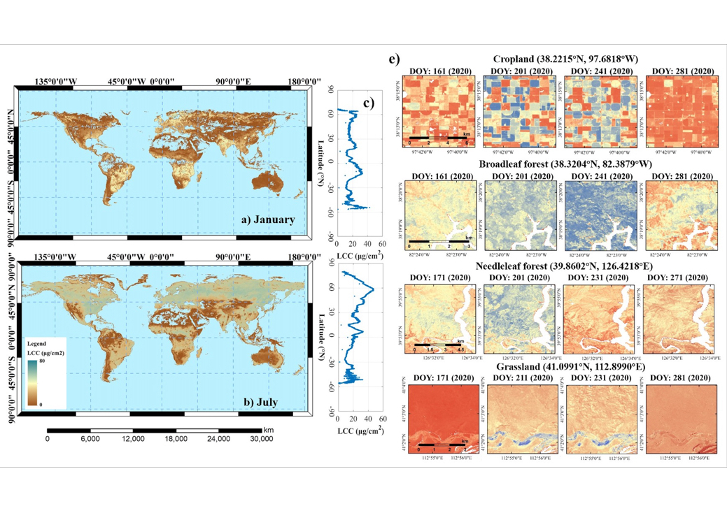 New Global Leaf Chlorophyll Dataset Enables Fine-Scale Vegetation Monitoring
Scientists from the Chinese Academy of Sciences have created the world's first global, high-resolution map of leaf chlorophyll content (LCC), offering a new way to closely track plant health and ecosystem productivity across the planet.
19 Jan 2026 -
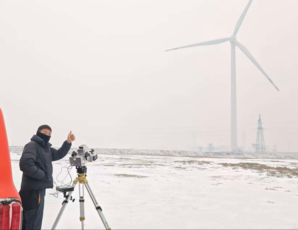 Aerospace Technologies Empower Data-Driven Wind Farm Management
Researchers from the Aerospace Information Research Institute of the Chinese Academy of Sciences (AIRCAS) have recently completed field validation of China’s first intelligent multi-parameter wind turbine diagnostic system, achieving non-stop, non-contact, intelligent, and real-time health monitoring of wind turbine blades. The system fills a key technological gap in intelligent operation and maintenance of wind power equipment in China.
15 Jan 2026 -
AIRCAS Researchers Unveil SARCLIP, Advancing Multimodal Foundation Models for SAR Remote Sensing
Researchers at the Aerospace Information Research Institute of the Chinese Academy of Sciences (AIRCAS), led by Prof. WANG Chao, have developed SARCLIP, the first multimodal foundation framework specifically designed for Synthetic Aperture Radar (SAR) imagery. The study was published in ISPRS Journal of Photogrammetry and Remote Sensing and represents a significant advance in bringing SAR data into the era of intelligent interpretation and large-scale foundation models.
09 Jan 2025 -
 Time-Gated Raman Spectroscopy Reveals How 3,000-Year-Old Sanxingdui Ivory Degraded—Despite Intense Fluorescence
A research team led by Dr. WANG Zhenyou, Research Fellow at the Aerospace Information Research Institute, Chinese Academy of Sciences (AIRCAS), has developed a microscopic time-gated Raman spectrometer that enables non-destructive, micrometer-scale chemical analysis of fragile archaeological ivory—even when strong fluorescence would normally obscure the signal. The study was published in ACS Applied Materials & Interfaces.
30 Dec 2025 -
 New Zero-Shot Learning Approach Advances Maize Phenotyping and Yield Estimation Without Model Retraining
A new study published in Smart Agricultural Technology introduces a zero-shot learning (ZSL) framework for maize cob phenotyping. This innovative pipeline enables accurate extraction of geometric traits and yield estimation in both laboratory and field environments without the need for model retraining.
29 Dec 2025

