

Newsroom
-
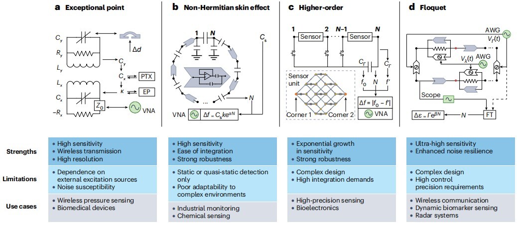 AIRCAS and Collaborators Review Advances and Future Applications in Topolectrical Circuit Engineering
Topolectrical circuits are evolving from laboratory platforms for exploring fundamental physics into practical hardware for high-precision sensing, wireless communications, memristive and neuromorphic computing, and embodied intelligence, according to a comprehensive review jointly led by researchers from the Aerospace Information Research Institute of the Chinese Academy of Sciences (AIRCAS) and the University of Chinese Academy of Sciences (UCAS), Zhejiang University, and the National University of Singapore, in collaboration with Beijing Institute of Technology and the University of Würzburg.
15 Jul 2026 -
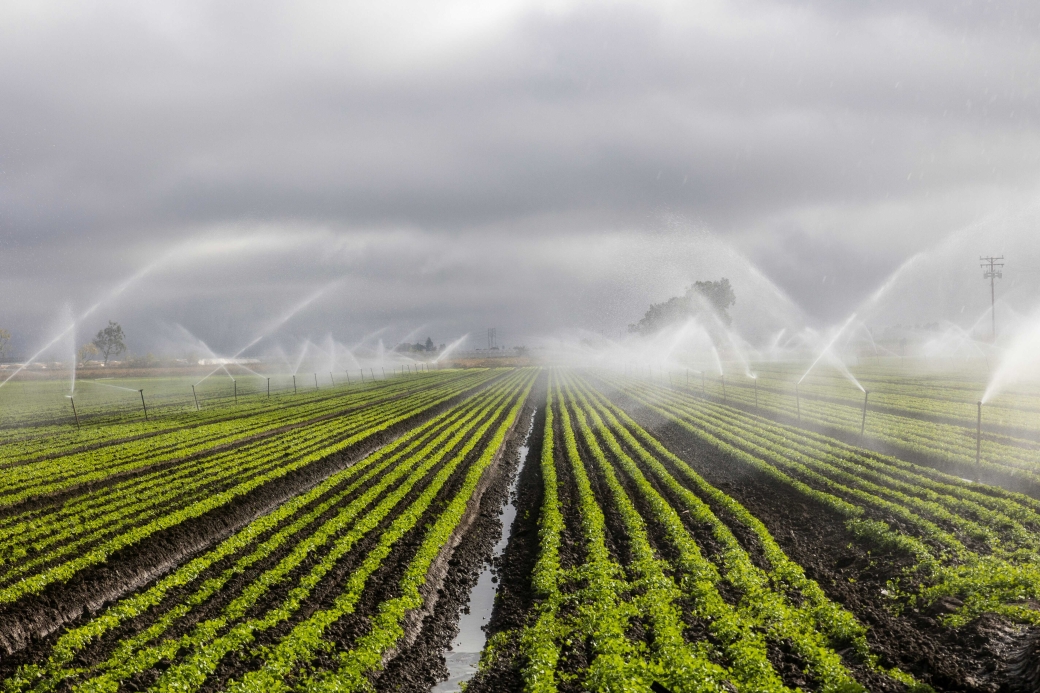 AI Method Enables High‑Resolution Mapping for China's Agricultural Irrigation Water Use Over 20 Years
A research team led by Prof. WANG Shudong from the Aerospace Information Research Institute of the Chinese Academy of Sciences (AIRCAS) has developed a new way to measure agricultural irrigation water use across China by combining satellite observations, physical laws, and artificial intelligence.
13 Jul 2026 -
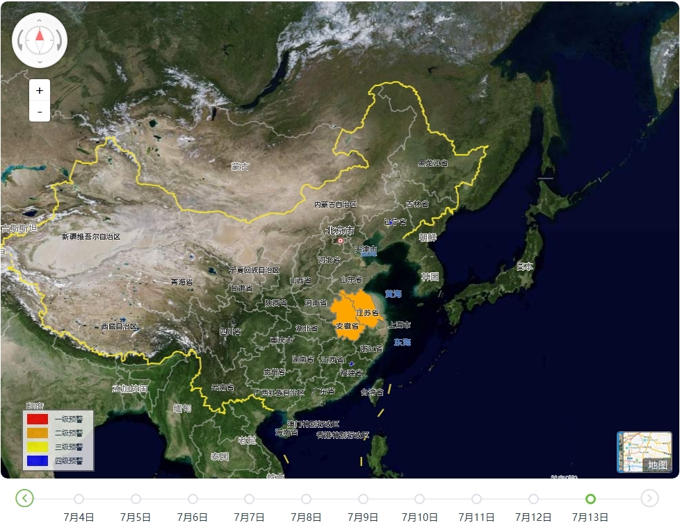 AIRCAS Launches Satellite Data Services to Support Flood Response Across China
The Aerospace Information Research Institute of the Chinese Academy of Sciences (AIRCAS) has launched a dedicated satellite data service and an integrated flood warning platform to support emergency response as persistent heavy rainfall causes flooding in several parts of China.
13 Jul 2026 -
 New Algorithm Unlocks 10-Minute Ocean Color Observations from Himawari-8
A new machine learning algorithm has enabled the Himawari-8 geostationary meteorological satellite to observe ocean color every 10 minutes, giving scientists a much sharper view of how coastal waters change throughout the day. By learning from high-quality MODIS ocean color observations, the transformer-based model overcomes key limitations of Himawari-8, including its relatively low signal-to-noise ratio, and significantly reduces retrieval errors compared with standard hourly products. The approach opens a new path for near-real-time monitoring of algal blooms, sediment transport, water quality, and other fast-changing ocean processes across the Asia-Pacific region.
08 Jul 2026 -
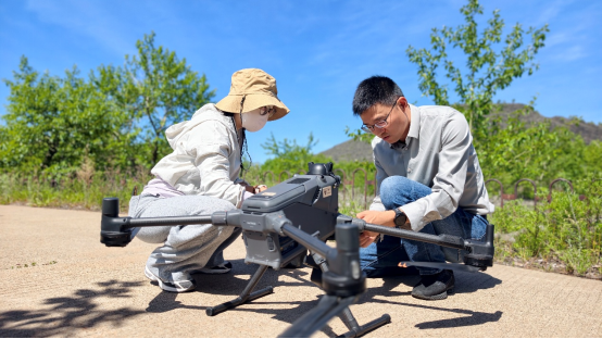 Space Technologies Advance Conservation of Wudalianchi UNESCO Global Geopark
Space technologies are helping scientists unlock new insights into one of the world's most remarkable volcanic landscapes. A team from the International Centre on Space Technologies for Natural and Cultural Heritage (HIST), a UNESCO Category 2 Centre specializing in applying space technologies to the conservation and management of World Heritage sites, Biosphere Reserves, and UNESCO Global Geoparks, recently completed a five‑day remote sensing survey and geological heritage assessment at Wudalianchi UNESCO Global Geopark. The project produced high‑resolution data to support conservation, monitoring, and UNESCO revalidation efforts.
07 Jul 2026 -
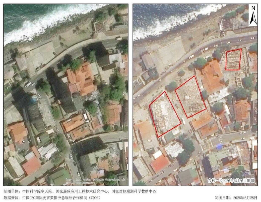 China GEO Mobilizes Satellite Support for Venezuela Earthquake Response
A 7.1-magnitude earthquake struck Venezuela on June 25, 2026, causing widespread damage in La Guaira state, north of the capital Caracas. According to figures released by the local government on July 2, the death toll had risen to 2,595 and the number of injured to 11,267.
06 Jul 2026

