

Newsroom
-
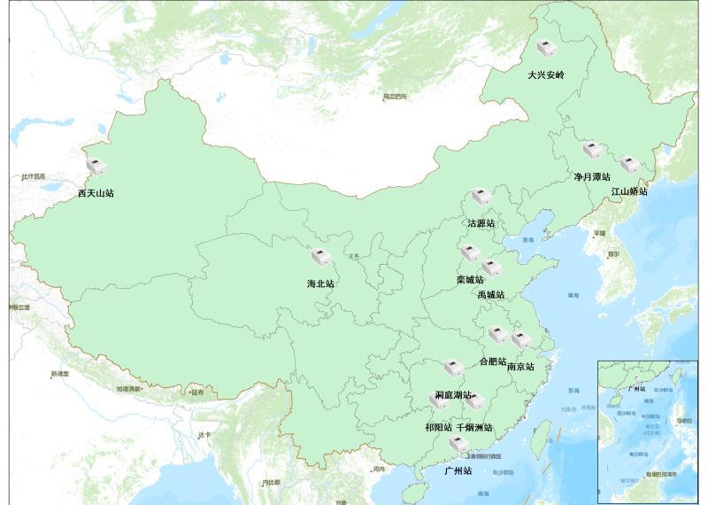 China Builds Automatic Leaf Area Index Monitoring Network
BEIJING, July 29 (Xinhua) -- Chinese researchers have realized continuous national-scale ground observation of the leaf area index by building an automatic monitoring network, according to the Aerospace Information Research Institute of the Chinese Academy of Sciences on Wednesday.
29 Jul 2020 -
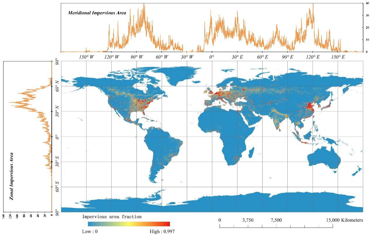 Chinese Researchers Undertake Impervious Surface Mapping
BEIJING, July 28 (Xinhua) -- Chinese researchers have generated a global 30-meter impervious surface map with high accuracy.Researchers from the Aerospace Information Research Institute under the Chinese Academy of Sciences derived the global impervious and non-impervious training samples and generated an accurate global impervious surface map at a resolution of 30 meters for 2015 based on multi-source multi-temporal remote sensing datasets.
29 Jul 2020 -
 China's Probe Radar to Explore Internal Structure of Mars
BEIJING, July 24 (Xinhua) -- After landing on Mars, China's Tianwen-1 probe will detect the surface and internal structure of the red planet by using its onboard radar equipment.A ground-penetrating radar, a key probe instrument, was developed by the Aerospace Information Research Institute under the Chinese Academy of Sciences. It is expected to survey the Martian soil and ice, and to collect data about the structure beneath the planet's surface at depths of between 10 and 100 meters.
25 Jul 2020 -
 Geovis Technology Co., Ltd Listed on SSE STAR MARKET
On July 8, 2020, the Geovis Technology Co., Ltd (GEOVIS), a high tech company controlled by the Aerospace Information Research Institute (AIR), made its debut on the sci-tech innovation board at the Shanghai Stock Exchange, also known as SSE STAR Market, with opening gains of 425%.
20 Jul 2020 -
 China Realizes Land Degradation Neutrality
On June 17, the 26th World’s Desertification and Drought Day, The CAS “ Big Earth Data Science Engineering” Program (CASEarth) released their research results of using big Earth data in support of land degradation neutrality assessment along Belt and Road Region.The report shows that China has achieved land degradation neutrality in advance, and the net land restoration area accounts for 18.24% of the world's total, ranking first in the world, and contributing greatly to global land degradation neutrality.
19 Jun 2020 -
 From Space to Sites: Satellites in Support of China’s Heritage
To celebrate this year’s festival falling on June 13, the International Centre on Space Technologies for Natural and Cultural Heritage (HIST), the first UNESCO Category 2 Centre dedicated to the applications of space technologies for the conservation, management and sustainable development of UNESCO-designated sites, is preparing a photo show of several China’s well-known Cultural and Natural Heritage Sites.
13 Jun 2020

