CAS Unveils Breakthrough in "Microwave Vision" SAR 3D Imaging
The Aerospace Information Research Institute of the Chinese Academy of Sciences (AIRCAS) announced a pioneering research breakthrough on April 9, 2025: a theoretical methodology for synthetic aperture radar (SAR) 3D imaging. Leveraging the implicit "microwave vision" semantics within images, this novel approach significantly achieves higher-precision, lower-cost, and more robust 3D imaging. It provides support for remote sensing fields like urban mapping and disaster monitoring.
With all-weather, day-and-night imaging capabilities, SAR serves as a critical technology for high-resolution Earth observation. Expanding aperture to elevation dimension, SAR 3D imaging effectively mitigates the geometric distortions caused by terrain projection in SAR 2D imagery, thereby enhancing recognition accuracy and modeling capabilities, establishing itself as a prominent direction.
Developed collaboratively by an AIR-led team alongside multiple research institutions, the new "microwave vision" approach integrates radar signal processing with AI. By semantically interpreting radar echoes, the system automatically reconstructs 3D features of buildings, landscapes, and other targets. This physics-guided, intelligence-driven method reduces required observations by over 50%, while improving or improves elevation accuracy by more than 30% under the same conditions.
Currently deployed in China's airborne and spaceborne SAR ground processing systems, it enables high-precision terrain and critical infrastructure mapping in challenging environments complex, such as the cloud-prone mountainous and urban areas of western China. Notably, it has also been successfully extended to the glacier penetration 3D imaging filed, achieving the first ice thickness measurements of compound valley glaciers in Qilian Mountains.
Furthermore, the research team further developed a prototype microwave vision 3D SAR (MV3DSAR) system with full-polarimetric capabilities, adjustable baselines and multi-channel consistency.
Through multiple flight experiments utilizing this system, the team has created the field's first open-source Microwave Vision 3D dataset, published in the Journal of Radars. This landmark contribution not only fills a critical gap in accessible 3D SAR data but has also gained international attention. Downloaded over 11,000 times by researchers from more than 200 worldwide institutions, it demonstrates a global impact.
DING Chibiao, CAS Academician and the project leader, emphasized that the technology's transformative potential: Our Microwave Vision SAR 3D imaging breakthrough represents a paradigm shift – dramatically reducing system complexity and operational costs. This intelligent development holds great significance in improvement for both current Radar systems and next-generation 3D SAR architectures." The breakthrough solidifies China's leadership in advanced remote sensing, with implications for climate science, disaster management, urban planning, and global geospatial resilience.
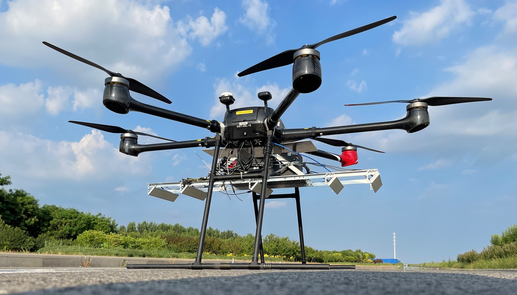
Microwave Vision 3D SAR (MV3DSAR) System. (Image by AIR)
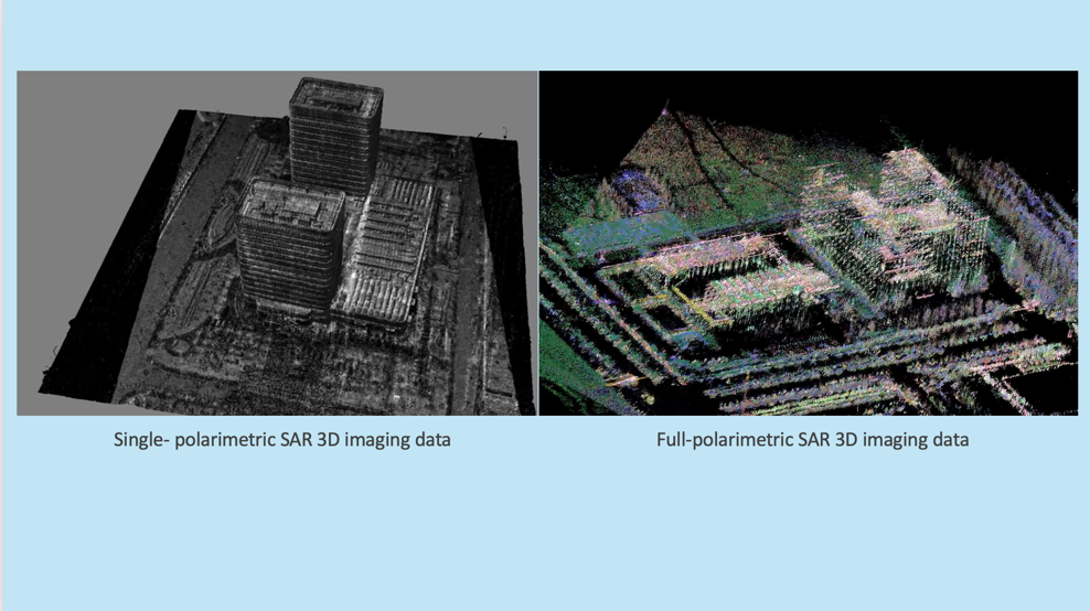
SAR microwave vision 3D imaging data. (Image by AIR)
News & Events