Field Campaign Conducted to Calibrate SDGSAT-1
A radiometric calibration team of the International Research Center of Big Data for Sustainable Development Goals (CBAS) went to Dunhuang, Gansu Province to carry out the vicarious radiometric calibration experiments of the SDGSAT-1 satellite during its on-orbit operation from October 26 to November 30, 2022.
The experiments would be carried in Dunhuang, Gansu province, and Dali, Yunnan province. The experiment conducted in Dunhuang focuses on vicarious radiometric calibration of multispectral and nighttime light payloads, while experiment in Dali focuses on the thermal infrared payload.
Experiment in Dunhuang was conducted at the China Radiometric Calibration Site (CRCS). The Dunhuang radiometric calibration site is around 1105-1250m, with the area of 20km?0km. It has a mid-latitude dry continental climate with little rain and basically no vegetation coverage. The site is located at the Danghe alluvial fan in the gobi, with surface composed of a variety of rock debris, gravel, sand and clay. The surface reflectance is stable which ranges from 14% to 25% in the near-infrared band. The difference of surface reflectance over many years is no more than 5%, and the change rate of site uniformity is less than 2%. The days with aerosol optical thickness less than 0.2, accounted for 73% of the whole year. Dunhuang radiometric calibration site is recommended as one of the commonly used radiometric calibration sites by the Earth Resources Observation and Science Cal/Val Center (EROS) due to its advantages of flat terrain, uniform surface, good directional characteristics and low aerosol content.
This experiment utilized the surface reflectance measurement ASD, combined with the solar photometer CE318, automatic weather station, operational atmospheric profile measurements, and light arrays for nighttime light, to conduct simultaneous measurements of surface and atmosphere at the satellite overpassing time, including surface reflectance, atmospheric parameters (AOD, water vapor, etc.), and atmospheric profile (temperature, pressure, etc.).
Data collected in the field experiment would be used for the radiometric calibration and evaluation of multispectral and nighttime light payloads status. Meanwhile, it also provides technical support for the quantitative application of remote sensing data and thus providing more accurate data for the SDG-related research.
A total of 46 satellite simultaneous observations were achieved in this scientific experiment, including SDGSAT-1 satellite, Jilin-1 satellite, Landsat 8/9, Sentinel 2A/B, FY-3E and ZY series hyperspectral satellites, and more than 20 satellite data were obtained without weather effects (SDGSAT-1 satellite 6 times, 4 times Jilin No.1 satellite, 4 times Landsat series, 4 times Sentinel series, 5 times FY3E satellite, 3 times hyperspectral satellite).
The data obtained from this expedition will serve as the basis for the evaluation of the nighttime light and multispectral payload radiometric performance of SDGSAT-1 satellite, and lay a solid foundation for the high-precision quantification of SDGSAT-1 satellite products.
According to the overall arrangement of SDGSAT-1 (2022) site calibration experiment, the radiometric calibration team would head to Dali, Yunnan province to carry out thermal infrared payloads onboard SDGSAT-1 satellite and other satellites in Erhai.
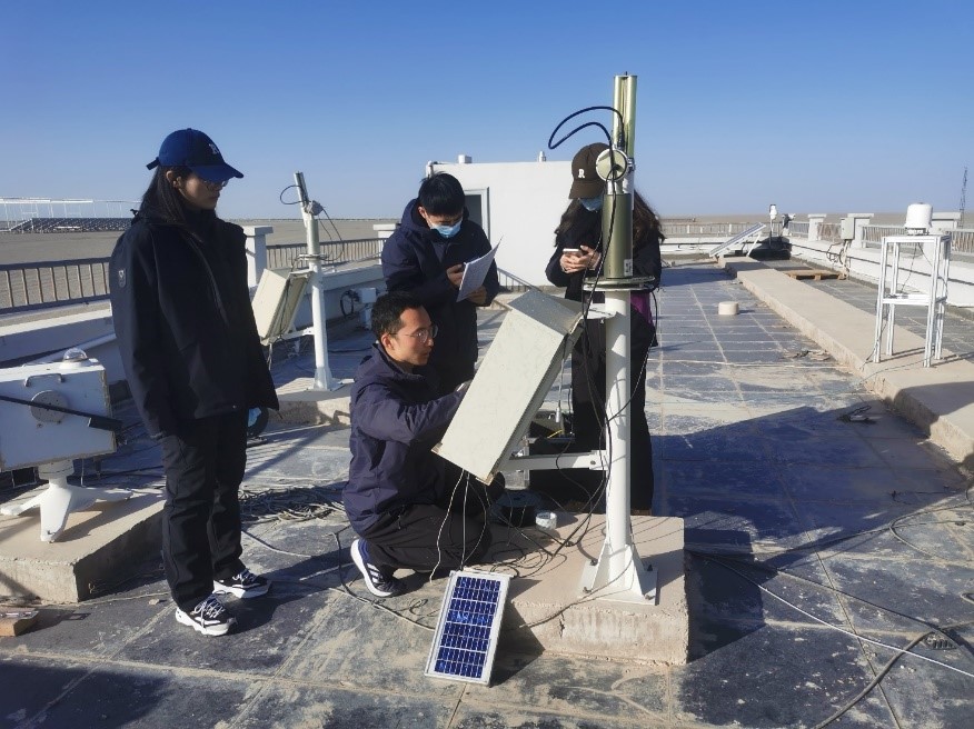
Installation of the solar photometer.
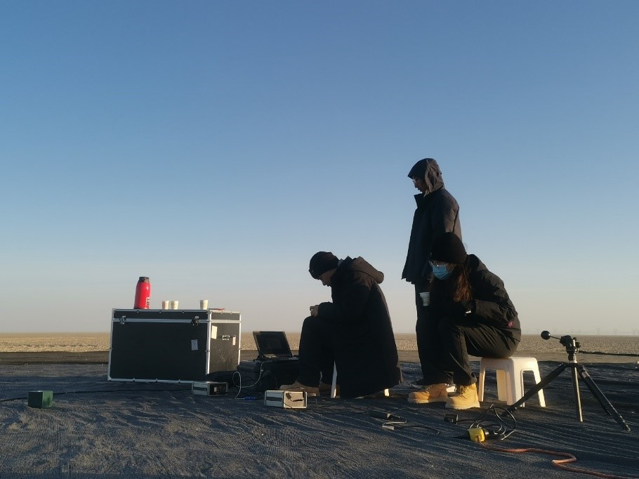
Atmospheric parameter measurement.
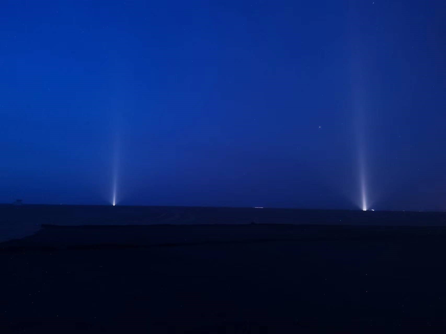
Light arrays for the nighttime light measurement during the satellite overpassing time.
News & Events