Progress in China-Mymmar Joint Remote Sensing Survey and Mapping of Bagan World Heritage Site
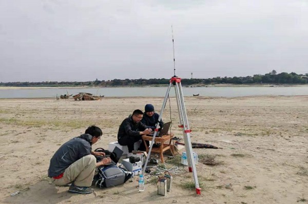
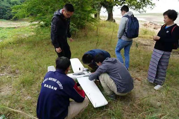
At the invitation of the Department of Archaeology and National Museum (Bagan Branch), the Ministry of Religious Affairs and Culture, Myanmar, the DBAR-Heritage World Natural and Cultural Heritage Working Group(WG) carried out the UAV-based optical remote sensing survey in Bagan World Heritage Site from December 25, 2019 to January 6, 2020. During the period of field work, with the support of Myanmar, the Chinese scientific research team carried out 17 UAV flights which covered about 1000 kilometers of flight lines and 240 square kilometers of heritage area, and obtained approximately 266 GB of raw aerial remote sensing data with ground sample distance better than 10cm.
On January 6, 2020, the Chinese side completed the sorting of the UAV optical remote sensing data of Bagan site, and held a data handover ceremony in the Bagan Branch Office of the Department of Archaeology and National Museum, Myanmar. The data including: one data-list, 266 GB of raw UAV remote sensing imagery in 10790 pieces. Subsequently, after data-processing work of UAV optical remote sensing images, China and Myanmar will officially launch a handover ceremony of comprehensive products in near future.
In December 2016, the Institute of Remote Sensing and Digital Earth of the Chinese Academy of Sciences initiated the Digital Belt and Road (DBAR) International Scientific Program. In March 2017, the World Natural and Cultural Heritage Working Group under the DBAR Program (DBAR-Heritage) was launched in Beijing. DBAR-Heritage is responsible for the research on the protection and development of natural and cultural heritage along the Belt and Road. At the invitation of Wang Xinyuan who is the deputy director of UNESCO International Centre on Space Technologies for Natural and Cultural Heritage (HIST) and co-chair of DBAR-Heritage WG, Mr. Aung Aung Kyaw, director of the Department of Archaeology and National Museum (Bagan Branch), Ministry of Religious Affairs and Culture, Myanmar, visited HIST from October 16 to 20, 2018. The two sides discussed and made it clear that HIST and Bagan Branch jointly carry out a cooperative project on surveying, monitoring and protection of the temples, pagodas and stupas in Bagan site under the framework of DBAR-Heritage. At the same time, this cooperative research is an important research content of the research topic of the Protection and Sustainable Development of the Natural and Cultural Heritage along the Belt and Road which is supported by the Strategic Priority Research Program of the Chinese Academy of Sciences. The Center of Aeronautical Remote Sensing (CARS) of the Chinese Academy of Sciences has undertaken the mission of aerial remote sensing data acquisition which is also one of the key tasks of CARS’s international cooperation.
Field Work.

Bagan Branch (by -UVA).
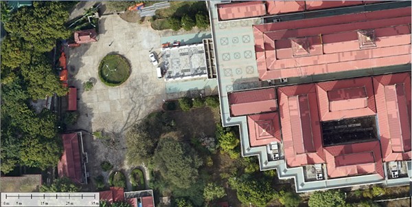
Bagan World Heritage -Orthophotographs (local part).
News & Events