AIR Completes UAV-based Field Measurement Campaign in Qinghai Golmud Area
Scientists from the CAS Key Laboratory of Quantitative Remote Sensing Information Technology with the Aerospace Information Research Institute (AIR) carried out a field measurement campaign in the Golmud area of Qinghai Province from August 7 to August 17, 2019.
This field measurement campaign is part of the project “spaceborne radiometric benchmark transfer calibration and ground-based demonstration”, which is supported by the National Key R&D Program of China.
In the campaign, both ground and atmospheric characteristics of two selected sites around the Golmud city were measured and collected. The bidirectional reflectance distribution function (BRDF) data of both sites were measured by UAV-borne spectrometer, which is an innovative technique to acquire BRDF data of ground target in larger scale.
The reflectance and emissivity data were also measured in both sites, and different sampling strategies to measure ground truths in satellite pixel scale were tested. In addition, the ground reflectance and atmosphere parameters were synchronously measured when GF-1, GF-2, and GJ-1 satellites passed over the areas. All data will be used for the radiometric calibration of these satellites.
The two sites in this field measurement campaign are selected as the radiometric reference sites for future test flights of aerostat-borne prototype sensors due to good atmospheric conditions and spatial uniformity. The scientific data obtained from this field campaign will help to solve a series of scientific problems related to the transfer of the space-borne radiometric benchmark, the observation element matching & conversion in vicarious calibration, and the pixel-scale ground truth value acquisition problem.
The work is expected to provide support for improving on-orbit calibration accuracy and to raise the quality of Chinese satellite remote sensing data.
The project “spaceborne radiometric benchmark transfer calibration and ground-based demonstration” which kicked off in 2018 was jointly undertaken by the CAS Key Laboratory of Quantitative Remote Sensing Information Technology as well as a dozen RS-related institutes in China. To meet increasingly higher quality data requirements in quantitative remote sensing applications, scientists are making efforts to build the transfer chain from the spaceborne benchmark sensor to other sensors to be calibrated, realize traceable consistency of different satellites’ data quality, and construct the technical system of spaceborne radiometric benchmark transfer calibration and ground-based demonstration. The results of this project will contribute to the on-orbit calibration of Chinese multi-series RS satellites and their data quality control, consequently ensure consistent radiometric quality across different satellite products.
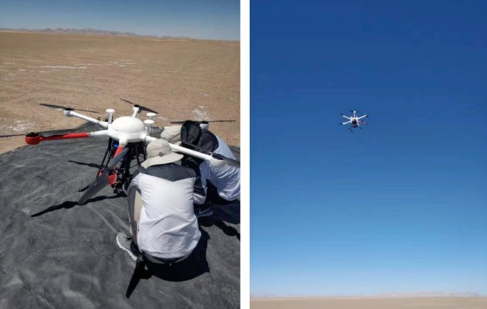
BRDF data measurement using UAV-borne spectrometer.
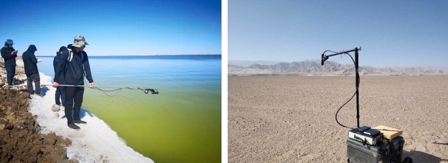
Ground reflectance measurement (left: lake, right: sandy soil).
News & Events