China GEO Supports Myanmar Earthquake Disaster Response
A 7.9-magnitude earthquake rocked Myanmar on March 28, 2025, causing widespread damage in Mandalay, the country's second-largest city. The death toll has risen to 2,056, with approximately 3,900 people injured and nearly 270 reported missing, according to the Myanmar's State Administration Council Information Team on March 31.
Responding to the request from the Department of Agricultural Research at Myanmar Ministry of Agriculture, ChinaGEO Secretariat activated its Disaster Data Response (CDDR) Mechanism to provide China's satellite imagery in support of disaster response.
More than thirty China's satellites arranged the emergency observation plan for the earthquake-affected areas of Mandalay province and the capital city of Naypyidaw. Within five days, 26.98 GB satellite post-disaster data, including Gaofen-1, Gaofen-6 and Jilin-1 optical satellites, were provided to Myanmar Ministry of Agriculture.
ChinaGEOSS Data Sharing Network (ChinaGEOSS DSNet) hosted by the Aerospace Information Research Institute (AIR) of the Chinese Academy of Sciences (CAS), also shared these data to UNOOSA/UNPIDER and UNOSAT/UNITAR to support their rapid response assessment work.
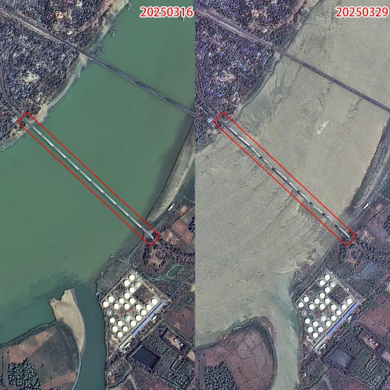
Preliminary satellite-derived bridge damage assessment at the Mandalay of Myanmar as of 29 March 2025 (Source by Jilin-1 satellite)
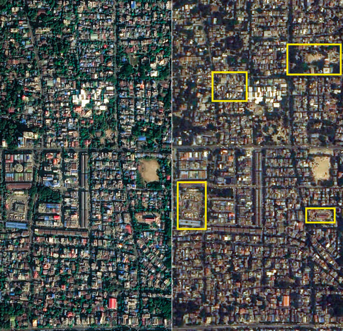
Preliminary satellite-derived building damage assessment at the Mandalay of Myanmar as of 29 March 2025 (Source by Jilin-1 satellite)
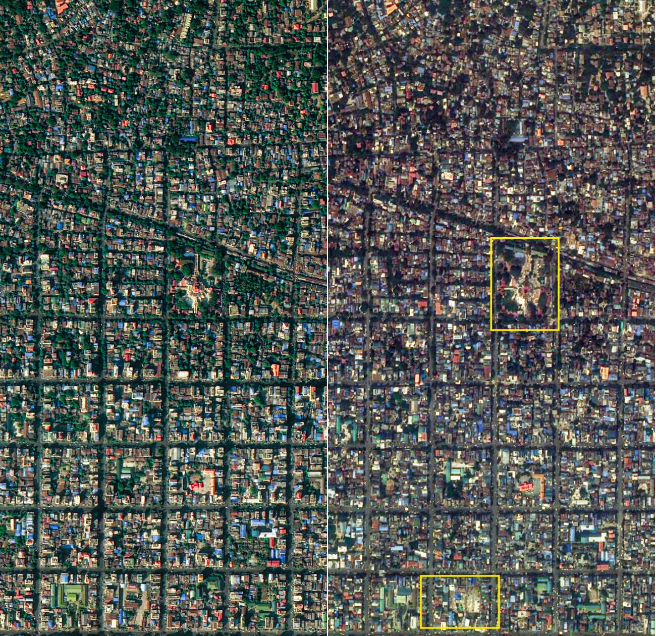
Preliminary satellite-derived temple damage assessment at the Mandalay of Myanmar as of 29 March 2025 (Source by Jilin-1 satellite)
News & Events