Satellite Images Show Majesty of China's Mega Water Project
Mar 23, 2023
March 22, 2023 is the 31th World Water Day, while March 22-28 is the 36th China Water Week.
China’s South-to-North Water Diversion Project transfers water from major rivers in the south to the drought-prone north through the middle, eastern and western routes. The middle route, the most prominent one begins at the Danjiangkou Reservoir in the Hanjiang River in central province of Hubei and runs northeastward across Henan and Hebei before reaching Tianjin and Beijing. Totaling some 1,267km in length, the route began supplying water in 2014.
A collection of satellite images presents the majestic views of the middle route of of this mega water diversion project. The images are produced by the scientists from the China Remote Sensing Satellite Ground Station, a big science facility hosted by the Aerospace Information Research Institute (AIR) of the Chinese Academy of Sciences (CAS).

Satellite image taken on June 17, 2022 shows Danjiangkou Reservoir in Hubei Province. The reservoir is the start of the middle route of the Project. (Image by AIR)

Satellite image taken on March 5, 2023 shows an aqueduct of the middle route of the Project in Xinzheng City, central China's Henan Province. (Image by AIR)
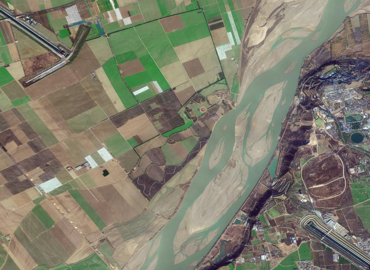
Satellite image taken on December 26, 2022 shows the Yellow River-crossing tunnel, a vital part of the middle route of the Project. (Image by AIR)
Satellite image taken on March 11, 2022 shows a buried culvert under the farmland of Hui County, Henan Province. (Image by AIR)

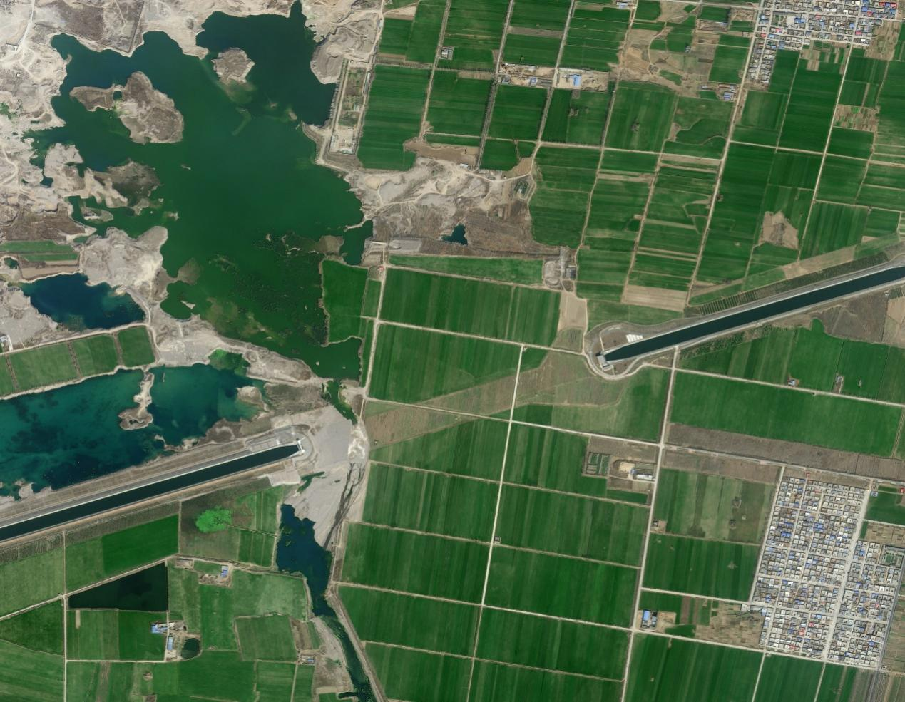
Satellite image taken on July 17, 2022 shows an aqueduct across the Tang River of the middle route of the Project in Anyang City, Henan Province. (Image by AIR)

Satellite image taken on March 5, 2023 shows Zhanghe River-crossing tunnel of the middle route of the Project in Anyang County, Henan Province. (Image by AIR)

Satellite image taken on July 17, 2022 shows a tunnel crossing Qilihe River of the middle route of the Project in Xingtai, Hebei Province. (Image by AIR)

Satellite image taken on March 5, 2023 shows the Tanghe River-crossing syphon tube of the middle route of the Project in Baoding, Hebei Province. (Image by AIR)

Satellite image taken on January 15, 2023 shows the syphon tube crossing Zhongyishui River in Yi County, Hebei Province. (Image by AIR)

Satellite image taken on August 11,2022 shows the part of the middle route of the Project at Zhongbei Township, Tianjin. (Image by AIR)

Satellite image taken on March 26,2022 shows the buried culvert crossing Juma River where the water eventually channels to Beijing. (Image by AIR)

Satellite image taken on January 20, 2023 shows the Tuancheng Lake in Beijing’s Summer Palace, the final destination of the middle route of the Project. (Image by AIR)
News & Events