Sceneries from Space
A collection of images captured by satellites show several Chinese landscapes from space. The images are processed by the engineers from the China Remote Sensing Satellite Ground Station, a big science research facility hosted by the Aerospace Information Research Institute (AIR), Chinese Academy of Sciences (CAS).
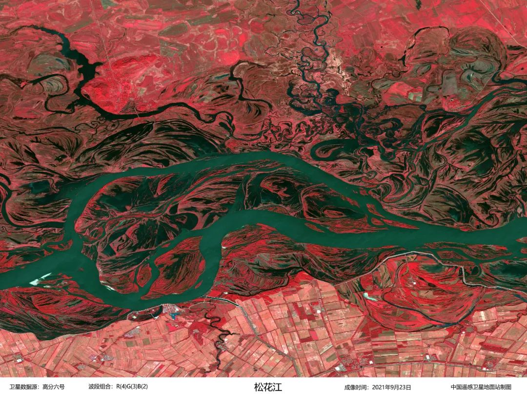
Image acquired by GF-6 on September 23, 2021 shows Songhua River in northeastern China. (Credit: AIR)

Image acquired by GF-1 on August 18, 2020 shows the Great Canyon region of the Yalu Tsangpo River in the Tibet Autonomous Region, China. (Credit: AIR)
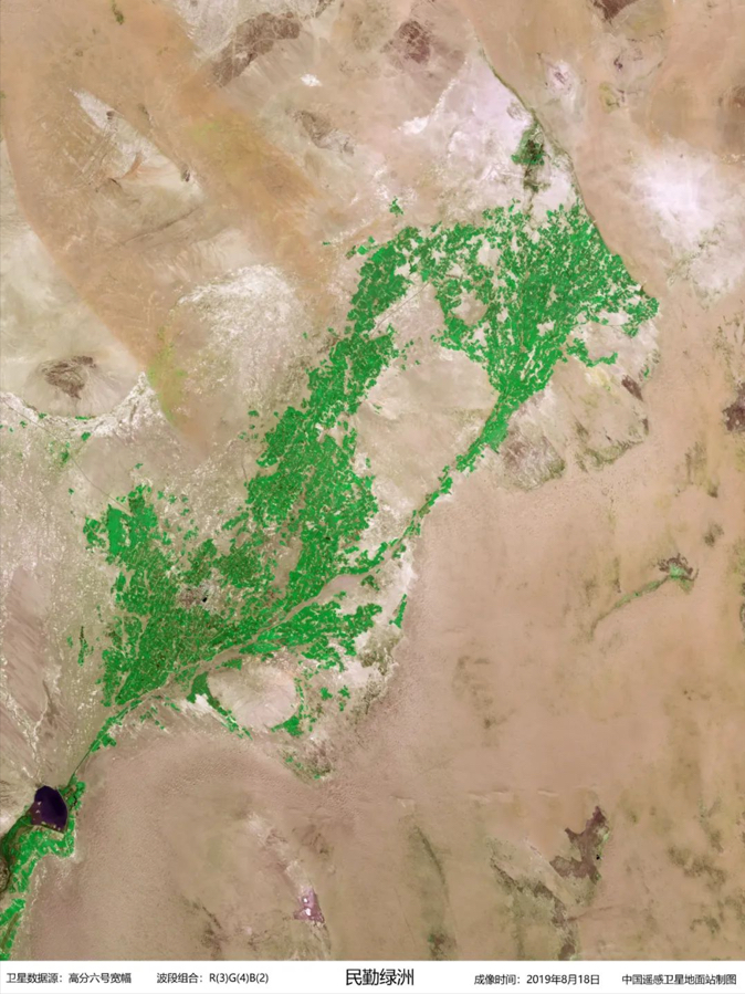
Minqin Oasis in northwest China's Gansu Province, image captured by GF-6 on August 18, 2019. (Credit: AIR)
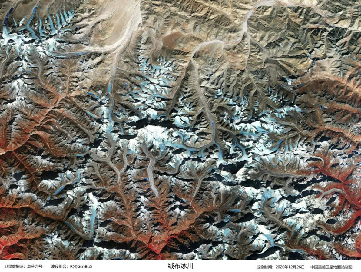
Image acquired by GF-6 on December 26, 2020 shows Rongbuk Glacier at the foot of Mount Qomolangma. (Image by AIR).
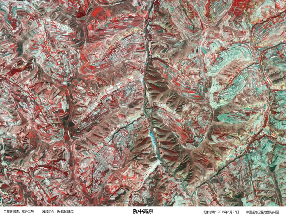
Image captured by GF-2 on 27 May 2018 shows Longzhong region of Loess Plateau in northwest China. (Image by AIR)
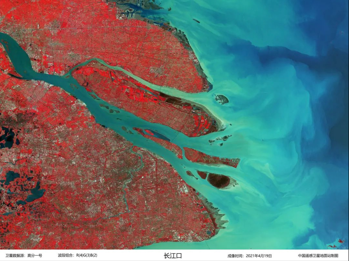
Yangtze River Estuary captured by GF-1 on April 19, 2021. (Image by AIR)

Three Gorges Dam captured by GF-2 on December 3, 2019. (Image by AIR)

Image captured by GF-2 on April 2, 2018 shows rapeseed flower fields in Yangxian County, northwest China's Shaanxi Province. (Image by AIR)
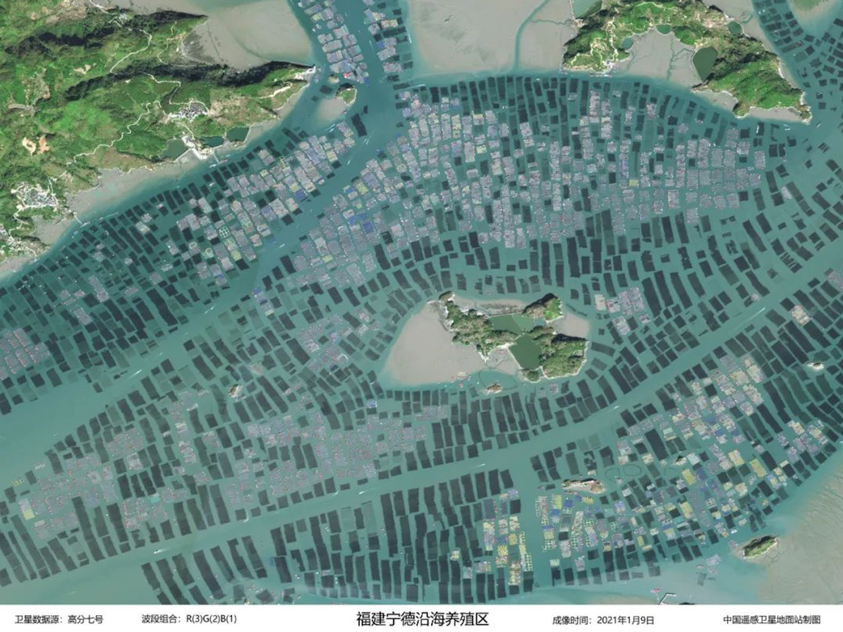
Coastal aquaculture zone in Ningde, southeast China's Fujian Province. The image is captured by GF-7 on January 9, 2021. (Image by AIR)
News & Events