Satellite Images Show Wetlands of China
The World Earth Day, which falls on April 22 every year, is a global campaign specially set up for world environmental protection, aiming at raising people's awareness of existing environmental problems, mobilizing people to participate in environmental protection campaigns, and improving the overall environment of the Earth through green and low-carbon life.
Wetlands have often been referred to as "Kidneys of the Earth" because of their high and long-term capacity to filter pollutants from the water that flows through them. On the 52nd World Earth Day, scientists from the Aerospace Information Research Institute (AIR), Chinese Academy of Sciences (CAS) will show some typical wetland reserves of China with satellite images.
The Migratory Bird Sanctuaries along the Coast of the Yellow Sea-Bohai Gulf of China (Phase I) are located in Yancheng City, Jiangsu Province, which is mainly composed of intertidal tidal flat and other coastal wetlands. Featuring world's largest intertidal tidal flat, the area is the key hub of the migratory route of East Asian-Australian migratory birds, including the most endangered and the highest degree of threat species, and is also the resting place, molting place and wintering place of millions of migratory birds around the world.
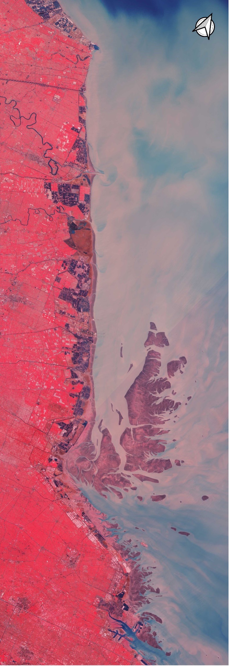
A remote sensing image (GF6-WFV, RGB: 432) captured on February 19, 2021 shows the migratory bird sanctuaries along the Coast of the Yellow Sea-Bohai Gulf of China.
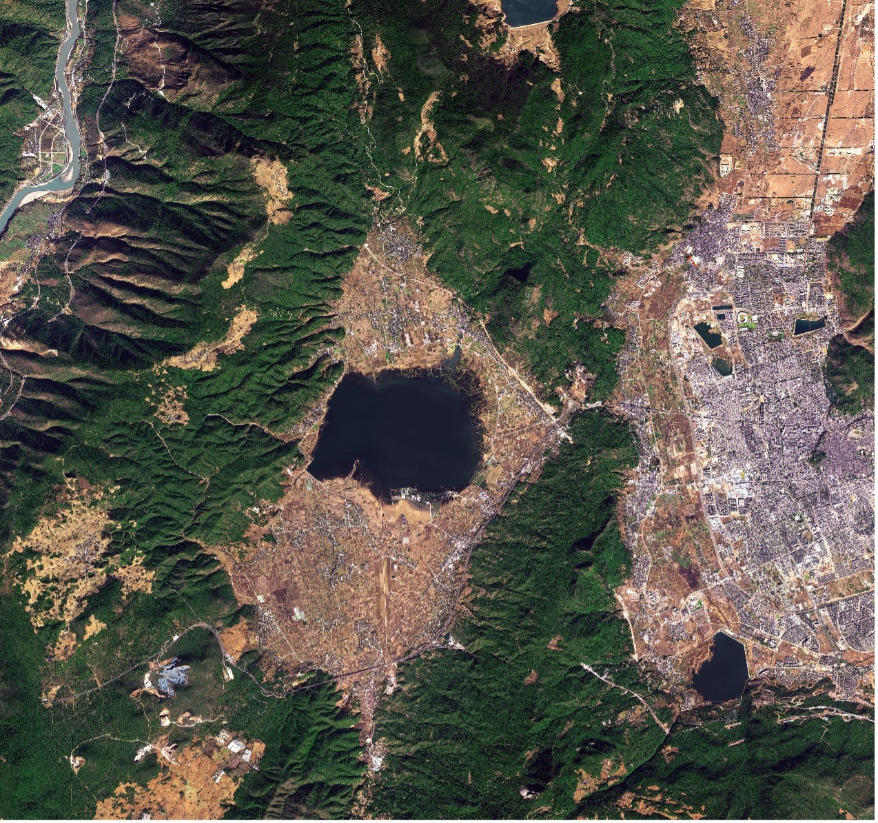
Poyang Lake National Nature Reserve is located in the south bank of the middle and lower reaches of the Yangtze River in the north of Jiangxi Province, and in the northwest corner of Poyang Lake, the largest freshwater lake in China. Every year from October to March of the following year, the water falls on the beach, and lakes of various shapes are scattered everywhere. At this time, the region is full of aquatic plants and wildflowers, showing charming scenery of a watery world.
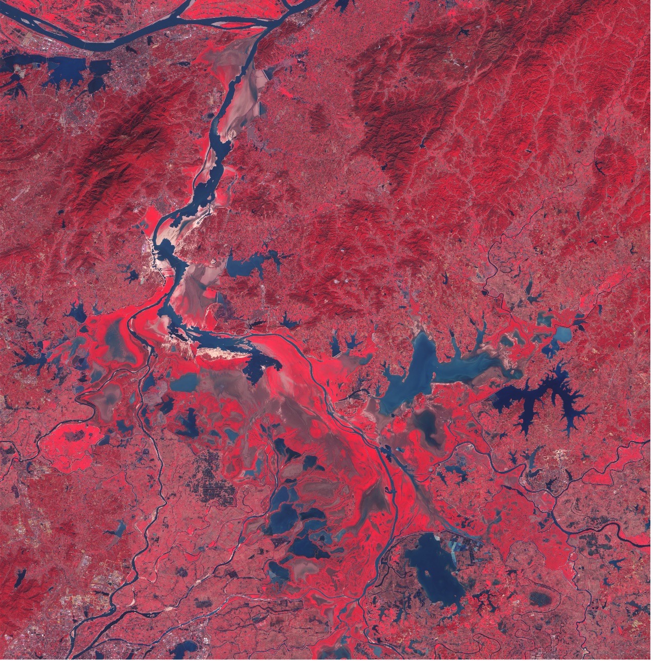
A remote sensing image of Poyang Lake National Nature Reserve (GF6-WFV, RGB: 432, acquisition date: 2021.02.19).
Zhangjiangkou National Mangrove Nature Reserve located in the estuary of Zhangjian River, Fujian Province, is dominated by mangrove forest in the estuary area and including intertidal mudflats and salt marshes. The mangrove coastal marsh and coastal arenaceous vegetation provides habitat for more than 154 birds species, including IUCN Red-listed species, as well as 240 other aquatic animal species and 224 vascular plants. It is also a spawning and breeding place for important fish species. The site plays an important role in typhoon resistance, coastline protection, purifying water and maintenance of regional microclimate.
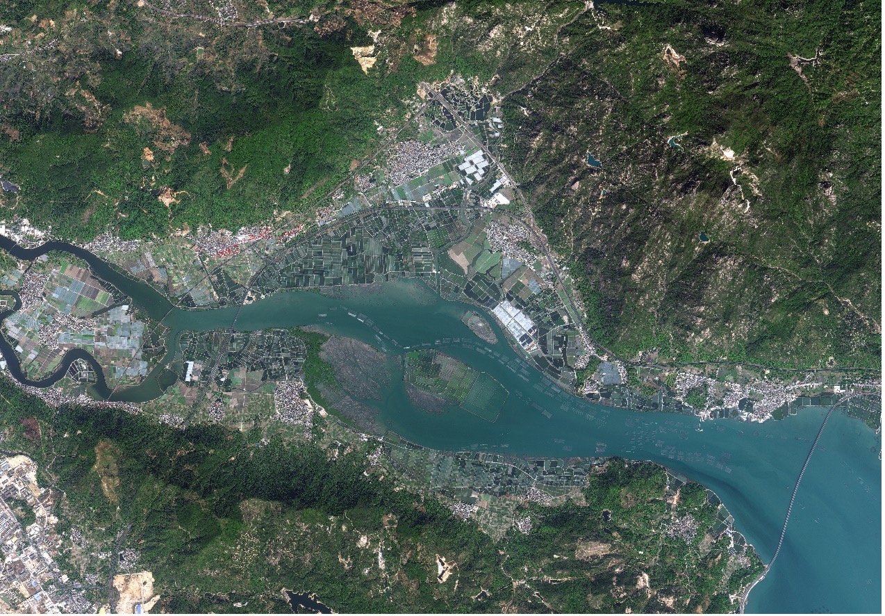
A remote sensing image of Zhangjiangkou National Mangrove Nature Reserve (GF1D, RGB:321; acquisition date: 2021.01.25).
Shengjin Lake, also known as "China's Crane Lake", is a national nature reserve and an important wetland. Lying at the confluence of Dongzhi and Guichi counties in Anhui Province, the lake is an ideal place for rare migratory birds to live in winter because of its mild climate, pollution-free water and lush natural vegetation.
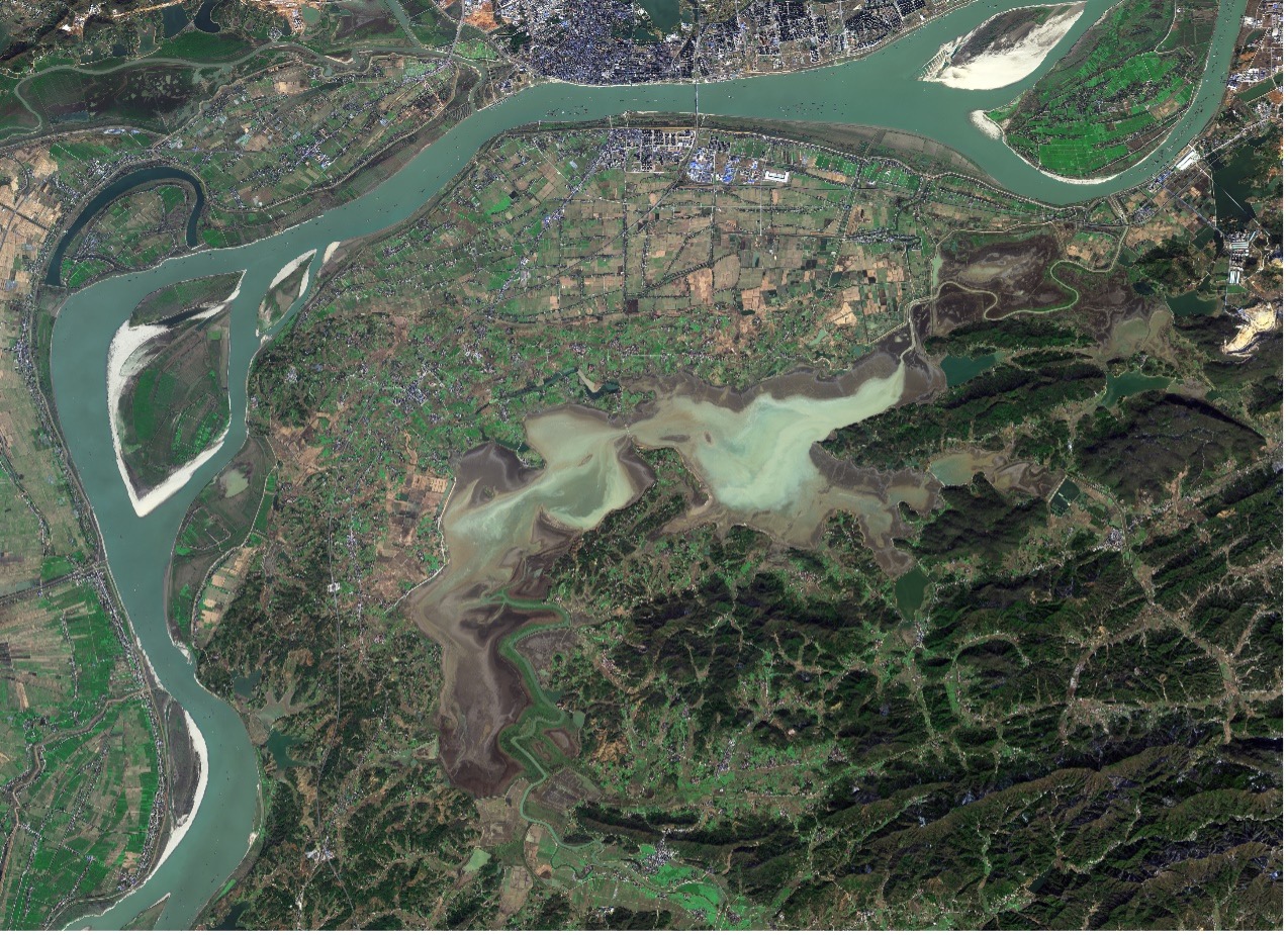
A remote sensing image of the Shenjin Lake Wetland Reserve (GF6-PMS, RGB:321, acquisition date: 2021.01.01).
Lashihai Plateau Wetland is located in Yulong County, Yunnan Province of southwest China, consisting of four natural plateau lakes: Lashihai, Wenhai, Wenbi Reservoir and Jizi Reservoir. The region is a paradise for migrated birds including rare and endangered birds and such as black stork, black-necked crane, Chinese merganser, and plants such as sea cauliflowers.
A remote sensing image of Lashihai plateau wetland (GF6-PMS, RGB:321; acquisition date: January 4, 2021).
Mapam Yumco Wetlands National Nature Reserve is located in the Pulan County, Tibet Autonomous Region in the southwestern China. The site constitutes lakes with most fresh water among the plateau elevation area on the Earth.The region, including Mapam Yumco Lake, Lake Rakshastal, as well as the surrounding swamp and river wetlands, is home to a large number of waterfowl such as black-necked cranes and spotted geese, and it is also one of the main corridors for rare wild animal populations such as Tibetan antelope and wild yak to migrate to the Himalayas in Tibet.
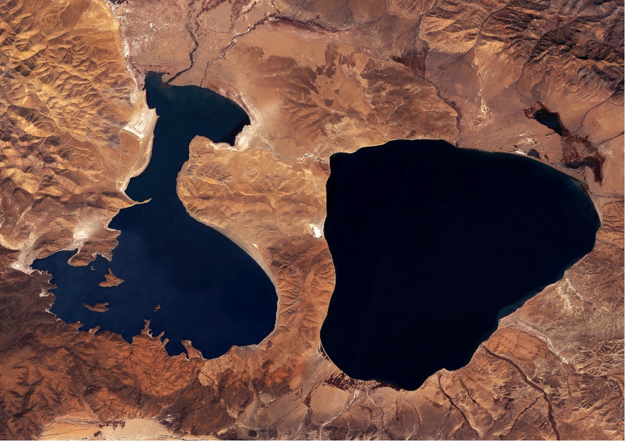
A remote sensing image of Mapam Yumco wetlands (GF6-PMS, RGB:321, acquisition date: 2020.10.17).
News & Events